
This week in Room 103, my seventh graders began their study of Ancient Rome. I wanted to spend the first few days building some background knowledge about Rome’s geography, founding, and growth before getting into the Roman Republic and Empire. We had a little bit of everything this week, including some local Cincinnati history, a traditional map activity, and a few EduProtocol combinations that I hadn’t tried before.
One thing I appreciated about this week was the flexibility of the lessons. We had a regular schedule most days, but Wednesday was only 30 minutes. Rather than completely changing what I wanted students to learn, I was able to adjust the structure of the lesson and still accomplish quite a bit. I also walked away from the week with a few things to think about, particularly when it comes to students’ mapping skills and how much they can accomplish when the instructional routines are familiar.
Monday: Ancient Rome Is Hiding in Cincinnati
Wicked Hydra
We kicked off our Ancient Rome unit with a local connection to Cincinnati history. I displayed two pictures for a Wicked Hydra. The first was the statue of Cincinnatus located at Sawyer Point, and the second was the statue of the wolf with Romulus and Remus located in Eden Park. Students had four minutes to generate questions about the first picture before switching to the second picture and repeating the process. There wasn’t much direction beyond looking closely at the pictures and asking questions about what they noticed.
What surprised me was that none of my students knew these statues were located in Cincinnati. I wasn’t expecting them to know the history behind the statues, but I figured at least a few students would recognize them. That wasn’t the case. It ended up being a pretty good way to introduce the unit because we had two local landmarks that connected directly to what we were about to study. I also liked that students were generating questions before they had any real background knowledge about the people or events represented in the pictures.
Number Mania
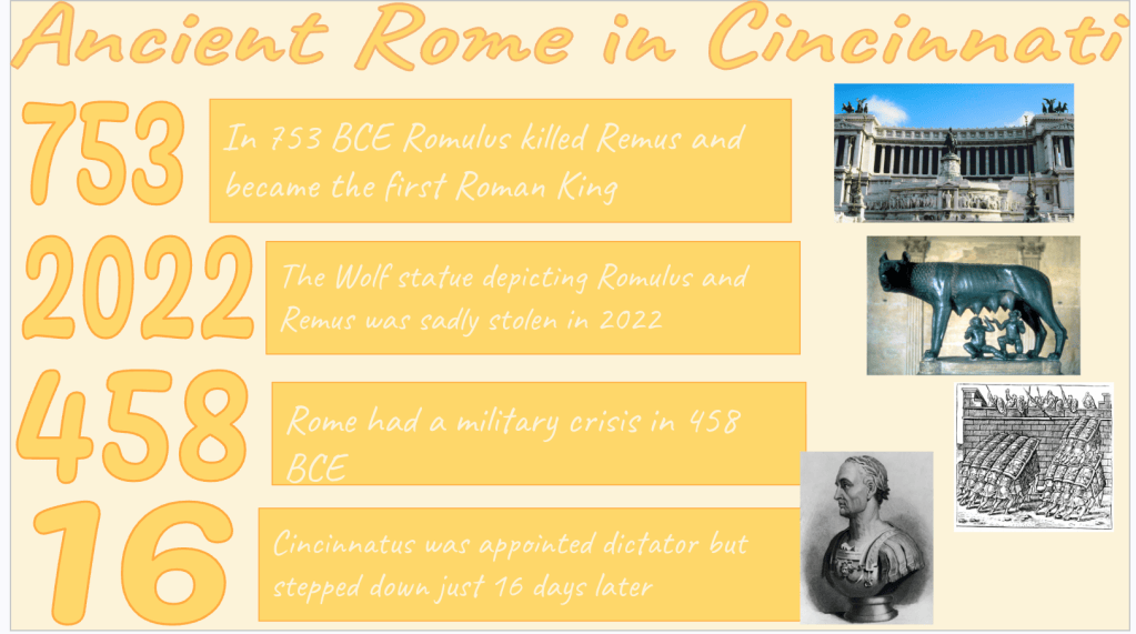
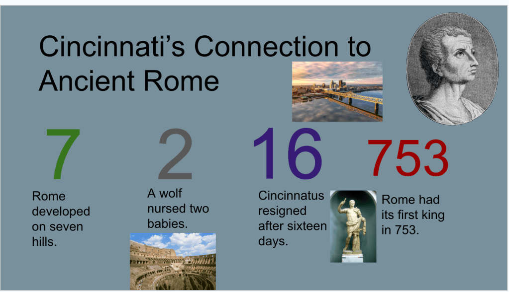
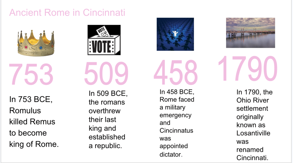
After the Wicked Hydra, we moved into a Number Mania using a reading I created called Ancient Rome’s History Is Hiding in Cincinnati. The reading focused on the legend of Romulus and Remus, the founding of Rome, the establishment of the Roman Republic, and the story of Cincinnatus. It also explained the connection between Cincinnatus, George Washington, the Society of the Cincinnati, and how our city received its name.
Students were asked to identify four significant numbers from the reading. For each number, they had to explain what it represented, why it mattered to Roman history or Cincinnati, and include a visual. I like using Number Mania because it gives students some flexibility in what they identify as important while still requiring them to explain the significance of the information. In this case, it also helped us establish some of the basic chronology of Rome while continuing the local history connection from the beginning of class.
Fast & Curious
We ended Monday with two rounds of Fast & Curious using Gimkit to introduce our Ancient Rome vocabulary. Nothing particularly fancy here. I wanted students to begin seeing and working with some of the terms that would continue to appear throughout the unit. We’ll continue revisiting this vocabulary over the next several weeks.
Tuesday: A Traditional Map Day
Mapping Ancient Rome
Tuesday was a pretty straightforward day. I don’t typically spend an entire class having students label and color maps, but I needed a quieter day, and I figured it would be a good opportunity to introduce some of Rome’s basic geography. Students received a blank map of Europe and used several reference maps to identify and label the Tiber River, Rome, the Alps, the Apennines, the Mediterranean Sea, the Atlantic Ocean, and the Italian Peninsula. They also had to identify Rome’s location and territorial expansion in 753 BCE, 27 BCE, and 117 CE.
What stood out to me was how much difficulty some students had transferring information from the reference maps to their blank maps. They could often find a location on one map, but figuring out exactly where to place it on another map was a different story. The spacing, scale, and orientation seemed to create more problems than I anticipated. I found myself helping students with things that I probably assumed they already knew how to do.
I’m glad we spent time on this because it reminded me that some of these basic geographic skills need more attention. I don’t know that I want to dedicate more full class periods to mapping, but I am wondering if smaller mapping activities throughout a unit might be beneficial. Even five or ten minutes of practice here and there could help students become more comfortable using different maps and transferring information between them. It’s something I’m going to think about as we move through the rest of the year.
Fast & Curious
We finished Tuesday with another round of Fast & Curious using our Ancient Rome vocabulary on Gimkit. This gave students another opportunity to practice the terms we introduced on Monday before moving into some more content-heavy activities later in the week.
Wednesday: Geography and a 30-Minute EduProtocol Smash
Wednesday was one of our shortened 30-minute classes, so I wanted something that would keep students moving while still requiring them to think about the content. Our focus was on how geography contributed to the growth of Rome. I decided to combine Sketch & Tell, a Frayer-style organizer, and a Tier List into one lesson. I’ve used all of these structures before, but I wanted to see how they would work together in a shorter class period.
Sketch & Tell
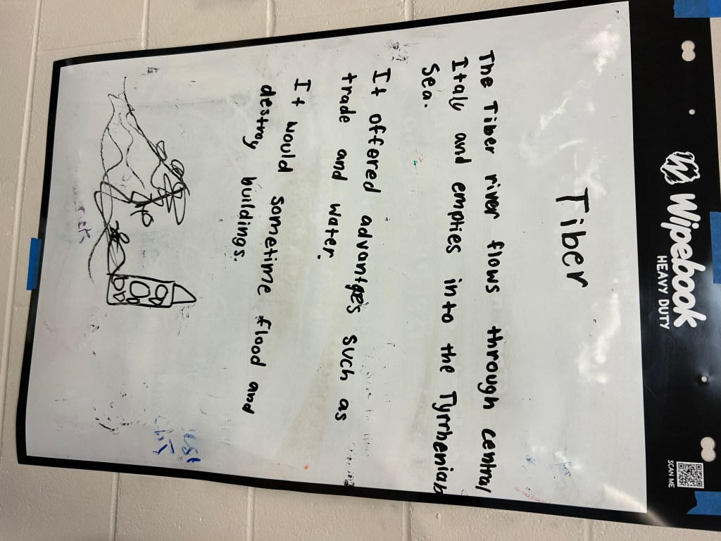
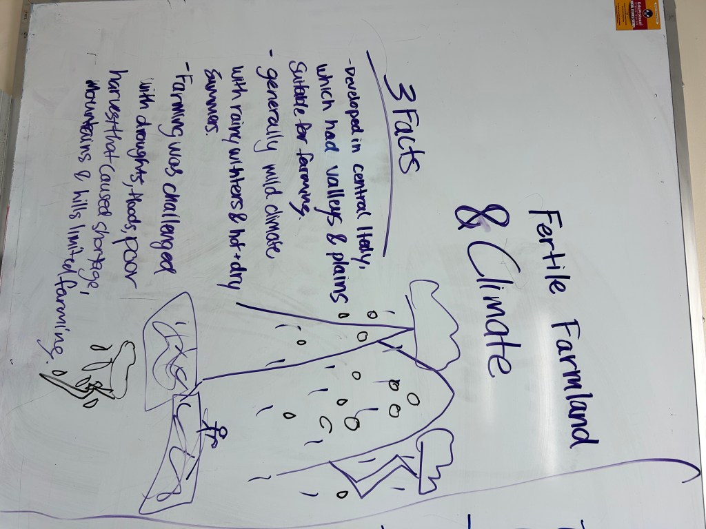
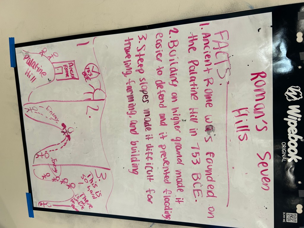
I started by giving students short readings about different geographic features that influenced Rome’s development. These included the Tiber River, the Alps and Apennines, fertile farmland, and the Italian Peninsula and Mediterranean Sea. Students had two minutes to read about their assigned feature before finding some whiteboard space with their group. From there, they had five minutes to create a Sketch & Tell that included a title, three facts, and a picture.
The purpose was pretty simple. Each group needed to develop an understanding of one geographic feature and create something that would help their classmates learn about it. With only five minutes to work, students had to identify the information they thought was most important rather than trying to include everything from the reading. Once the whiteboards were finished, we were ready to move into the next part of the lesson.
Frayer + Tier List
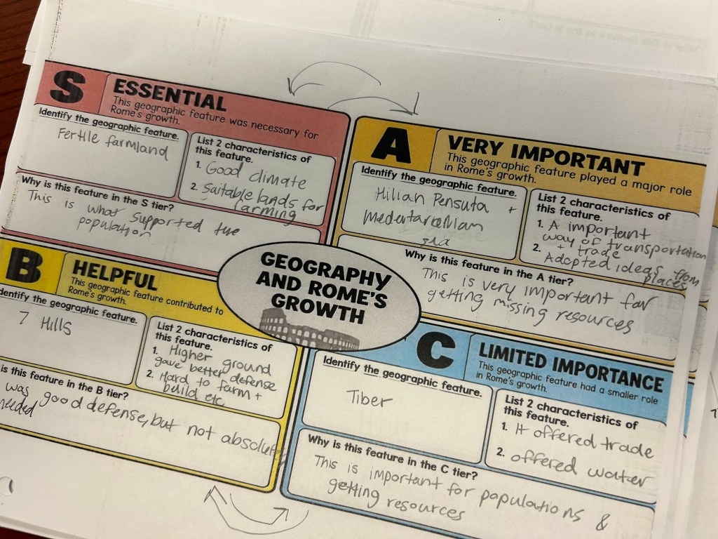
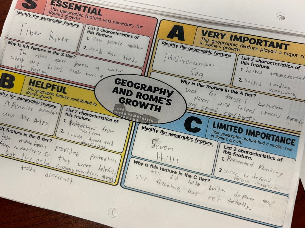
This was the part of the lesson I was most interested in trying. I combined elements of a Frayer with a Tier List to have students evaluate the importance of Rome’s different geographic features. Students walked around the classroom, read the information on the whiteboards, and completed an organizer that required them to place each geographic feature into one of four categories: S for Essential, A for Very Important, B for Helpful, and C for Limited Importance.
For each feature, students had to identify two characteristics and explain why they placed it in that particular tier. They had about ten minutes to gather information, discuss their choices, and complete their rankings. What I liked about this combination was that students couldn’t simply copy facts from the whiteboards and move on. They had to use those facts to make a decision about how much each feature contributed to Rome’s growth. There wasn’t necessarily one perfect way to rank everything, so students had opportunities to discuss their reasoning and defend their choices.
I thought the combination worked pretty well, especially considering our limited time. The Sketch & Tell provided the information, while the Frayer and Tier List required students to do something with it. It also built directly on Tuesday’s mapping activity. Students had already located these features on a map, and now they were examining why those locations mattered to the development of Rome.
Fast & Curious
We finished Wednesday with two rounds of Fast & Curious using Gimkit. In 30 minutes, students had read about geographic features, created whiteboards, gathered information from their classmates, ranked the importance of those features, and practiced vocabulary. It was a lot to fit into a shortened class, but the familiar structures helped keep things moving without spending much time explaining directions.
Thursday: Building a Timeline of Ancient Rome
Thursday was another day of combining EduProtocols, although this time we had our regular 45-minute class. After spending the first part of the week learning about Rome’s founding and geography, I wanted students to develop a basic understanding of some of the major events in Roman history. Rather than having everyone read the same passage or complete a traditional timeline from a textbook, I decided to use an Iron Chef followed by a Sketch & Tell-O Timeline.
Fast & Curious
We started with a quick three-minute round of Fast & Curious on Gimkit. This time, the questions focused on the geography content from Wednesday. I wanted to revisit some of that information before shifting our attention to the major events in Rome’s history.
Iron Chef
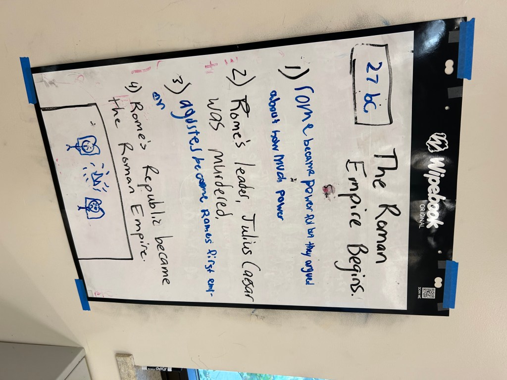
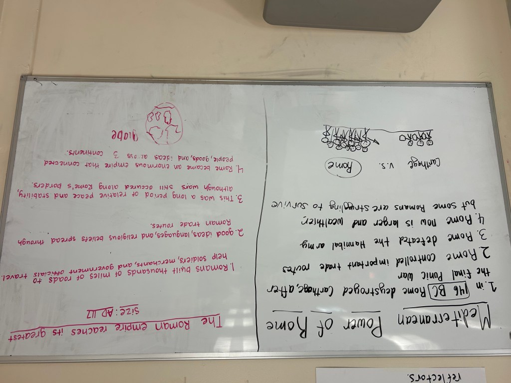
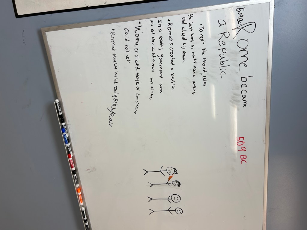
For the Iron Chef, I created six short readings, each focused on an important date in Roman history. The dates were 753 BCE, 509 BCE, 146 BCE, 27 BCE, 117 CE, and 476 CE. Together, these events provided students with a basic overview of Rome’s legendary founding, the establishment of the Republic, its military expansion, the beginning of the Empire, its greatest territorial extent, and the fall of the Western Roman Empire.
Each group received one reading and had three minutes to read about its assigned event. Students then found space on the classroom whiteboards and had eight minutes to create a title, include the year, identify four important facts, and draw a picture. I wanted each group to create a quick visual summary that their classmates could use to learn about the event. Since students were responsible for different dates, we ended up with information about all six events displayed around the room.
Sketch & Tell-O Timeline
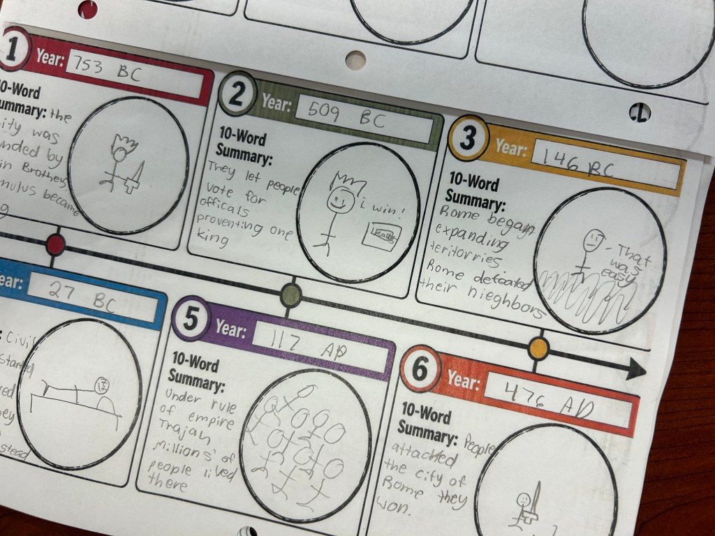
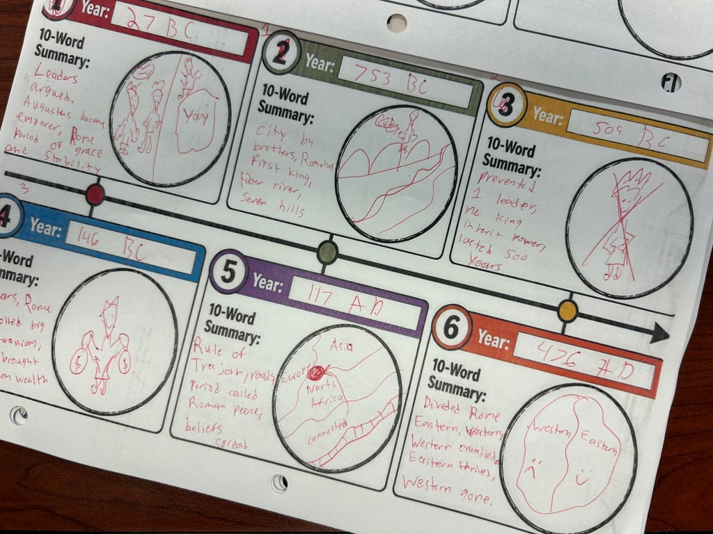
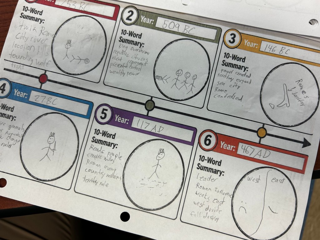
Once the Iron Chef whiteboards were completed, students received a Sketch & Tell-O Timeline. Their task was to walk around the classroom, read the information from each group, and place the six events in chronological order. For each event, they had to include the correct year, write a 10-word summary, and draw a picture that represented what happened.
One of my favorite parts of the lesson was listening to students discuss how to summarize each event in just ten words. It’s easy to copy a sentence from a whiteboard, but limiting students to ten words forced them to think about which information was actually important. I heard students discussing what details needed to be included, which words could be removed, and how to make their summaries accurately explain what happened. Those conversations were probably more valuable than the finished timelines themselves.
I also liked how similar the structure was to Wednesday’s geography lesson. Students started with a short reading, worked with their group to create something on a whiteboard, and then used information from their classmates to complete an individual task. On Wednesday, they were evaluating the importance of geographic features. On Thursday, they were organizing historical events chronologically and summarizing their significance. The overall structure was familiar, but the thinking required was different.
Final Thoughts
Overall, I thought this was a good start to our Ancient Rome unit. We covered some important background knowledge without spending the entire week taking notes or listening to me explain Roman history. Students were introduced to Rome’s founding, geography, territorial growth, and some of the major events that shaped its development. We also managed to connect the content to Cincinnati, which was something I hadn’t really taken advantage of in previous years.
Two things stood out to me this week. The first was Tuesday’s mapping activity and how much students struggled with transferring information between maps. It’s something I probably need to address more consistently rather than assuming students have already developed those skills. The second was how well Wednesday’s and Thursday’s lessons worked using similar structures. I didn’t need to reinvent everything for each lesson. I was able to use familiar EduProtocols, make a few adjustments, and have students engage with the content in different ways.
I think that’s one of the biggest benefits of using EduProtocols regularly. Students become familiar with the routines, which allows us to spend less time explaining how to complete an activity and more time actually working with the content. It also makes planning a little easier, especially when dealing with different class lengths and schedules.
Next week, we’ll continue building on this foundation as we move further into the history of Ancient Rome.
Lessons For The Week
Monday – Number Mania
Wednesday – Ancient Rome Readings, Frayer/Tier List Smash
Thursday – Sketch and Tell-O Timeline with Reading Link


